
Why Are the Sea, Mountains, and Food So Close in Itoshima? A Half-Day Walking Course on the Map
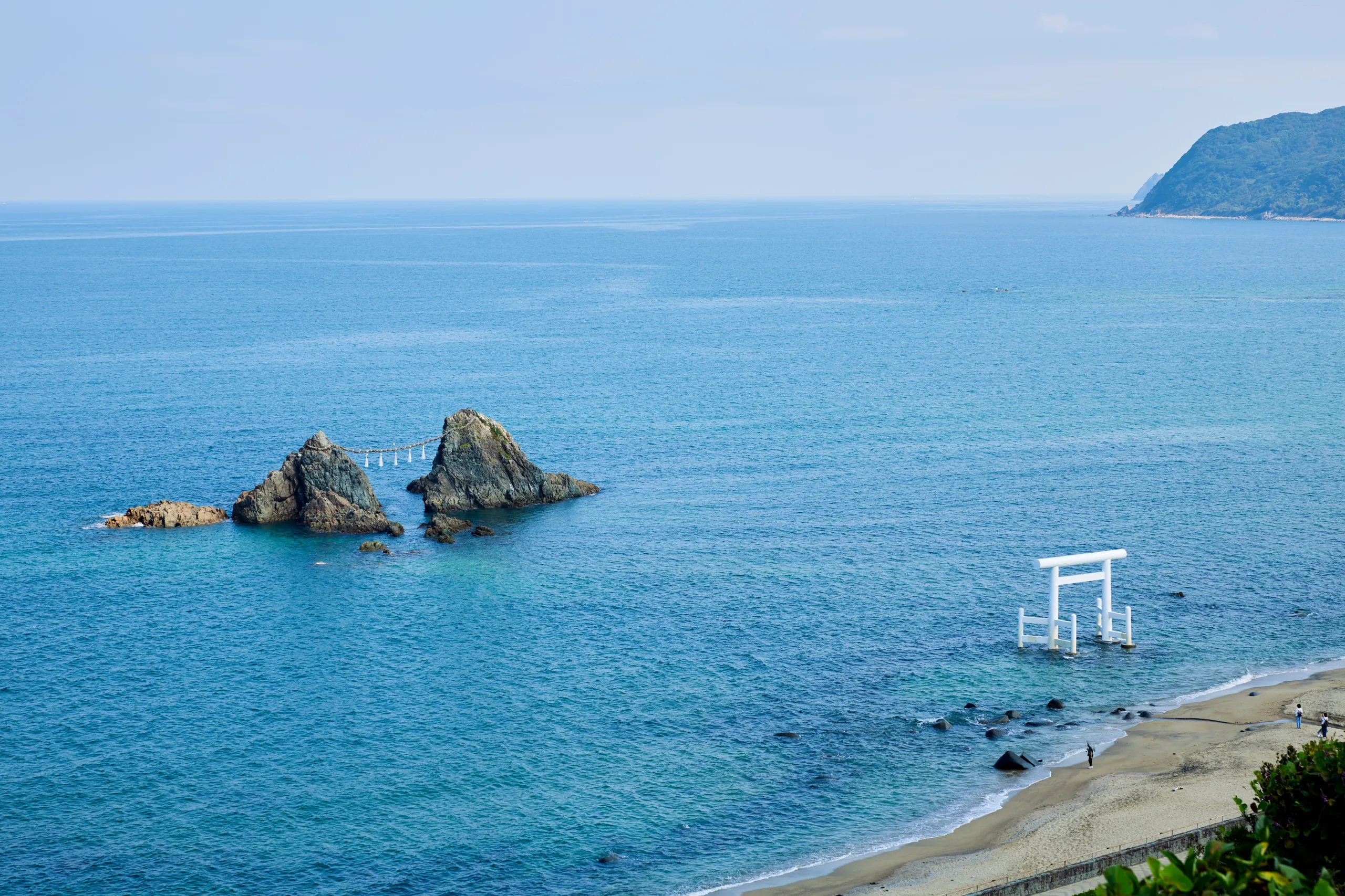
A little west of Fukuoka City. As you head there by train or car, the urban scenery gradually softens into gentle countryside, and beyond that, the sea and mountains draw closer. Itoshima’s popularity stems from its beautiful coastline, abundance of cafes, and photogenic spots — all true. But if you zoom out on the map, the true appeal of Itoshima lies even deeper.
Itoshima is shaped by the Genkai Sea to the north, the Seburi mountain range to the south, with the Itoshima plain spreading out in between. Sea, mountains, farmland, and urban areas overlap each other in close proximity, making it easily accessible from central Fukuoka City. This compact layout creates the distinctive “sea, mountains, and food all nearby” feeling unique to Itoshima.
This route shows you a half-day way to enjoy Itoshima not just as a “photogenic seaside” but by connecting its geography, history, and food on the map. Tracing the coastline, the plains, the ancient Ito-koku, direct sales markets, and famous sunset spots makes familiar Itoshima feel a little different.
How to Enjoy This Course
The route takes about 4 to 5 hours. By car, you can complete it in half a day; if cycling, it’s best to limit stops and take your time. The starting point is around Chikuzen-Maebaru Station. From there, you’ll travel through the Itoshima plain, historical sites, direct sales markets, and end at spectacular seaside views.
Looking at the map, Itoshima’s structure is easy to understand. Water flows from the mountains in the south, spreading out across the central plains, then opening toward the northern sea. That proximity means agricultural and marine products are nearby, and people have lived and exchanged culture here since ancient times.
1. Start by Gazing Over the Itoshima Plain: Ito-koku History Museum
Your first stop should be the Ito-koku History Museum. This place offers the key to seeing Itoshima not just as a tourist spot but as a place where people have gathered and cultures have intertwined for centuries.
Itoshima is believed to be where the ancient “Ito-koku” mentioned in the Chinese historical book Wei Zhi Woren Zhuan once stood. As an ancient gateway to the continent, culture flourished here long ago, with ruins and historical sites still scattered across the city. The artifacts excavated from the Hirabaru Ruins, including one of Japan’s largest bronze mirrors, have been designated national treasures.
The museum exhibits displays about Ito-koku, recreations of the Hirabaru Ruins excavation, and on its 4th floor, a viewing area that offers a panoramic overlook of the Itoshima plain. Taking in the geography here first will make the entire route that follows far more engaging.
Key takeaway: Itoshima was never just a peripheral area. Open to the sea with fertile plains and human settlements, it long served as a place of exchange and connection. This foundation leads to the richness seen in Itoshima today.
2. Itoshima Made by Mountain Water: Shiraito Falls
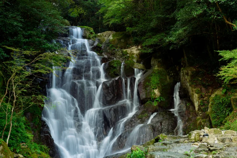
Next, head to the mountains on the south side. Shiraito Falls offers a chance to experience a side of Itoshima quite different from its seaside image—the charm of its mountain environment.
Shiraito Falls drops about 24 meters on the slopes of Mt. Hagane. The surrounding area is good for nature walks and dining, with seasonal attractions such as hydrangea blooms, yamame trout fishing, and flowing somen noodles.
It’s important to realize here that the mountains are not just a backdrop—they are a source supporting Itoshima’s food culture and daily life. Mountain water nourishes the plains, cultivating fields that ultimately pour into the sea. Though this flow seems obvious on a map, visiting the site makes it vividly tangible.
Itoshima’s appeal lies neither in the sea alone nor in the mountains alone. From mountains to plains, plains to sea—their proximity lets you experience a “cross-section” of Itoshima even in a half day.
3. The Hub of Itoshima’s Food: JF Itoshima Shima no Shiki
With the mountains and plains behind you, it’s time to focus on food. One of the best places to appreciate the closeness of Itoshima’s sea, mountains, and food is JF Itoshima Shima no Shiki.
Operated by JF Itoshima, Shima no Shiki is a direct sales market where you’ll find seafood from seven local fishing ports as well as vegetables, fruits, flowers, meats, eggs, and processed goods from local farmers. Inside, some shops offer seafood bowls and other meals. It’s truly a “kitchen” for both tourists and locals alike.
Rather than just hunting for “signature dishes” typical of tourist spots, try shifting your perspective here. Consider where the fish, vegetables, and fruits you see today came from. How do they connect with the mountains and plains you just explored and the coastline you’re heading toward?
Seeing these connections transforms a simple shopping trip or lunch into a moment of tasting Itoshima’s terrain.
4. Itoshima Open to the Sea: Sakurai Futamigaura
In the afternoon, head toward the sea. One of Itoshima’s most famous scenic spots is Sakurai Futamigaura.
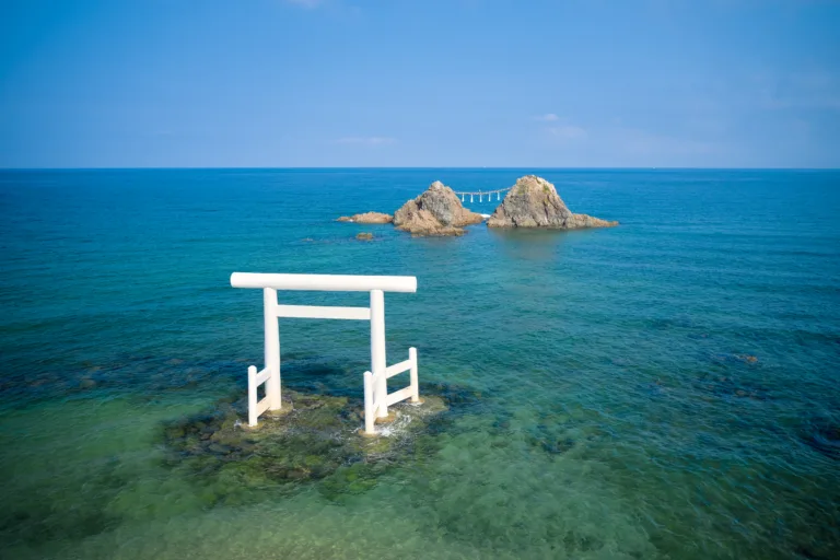
Sakurai Futamigaura is known for the white torii gate standing in the sea and the “Married Couple Rocks” (Meoto Iwa). While Futamiura in Ise, Mie Prefecture, is called the “Sunrise Futamiura,” this spot is famous as the “Sunset Futamigaura.”
What to admire here is, of course, the torii and the beauty of the sea. But looking at it on a map reveals something more interesting. The northern side of the Itoshima peninsula faces the Genkai Sea and opens wide to it. This has allowed external contact and fishing activities since ancient times, and today supports driving routes, cafes, and tourism flows.
Taking photos in front of the white torii is fun, but seeing it in the context of everything explored so far changes how you view the sea. Water and life starting from the mountains travel through the plains and finally open out to the ocean, and you feel like you’re standing at the end of that journey.
5. If You Have Time, Feel the Power of the Terrain at Keya no Oto
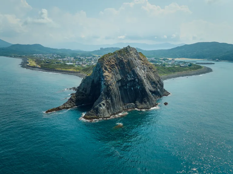
If your schedule allows, head further west to Keya no Oto. Here, Itoshima’s coastline isn’t just beautiful — the terrain itself is a major attraction.
Keya no Oto is a nationally-designated natural monument sea cave on the northwest part of the Itoshima peninsula. Sightseeing boats offer close-up views of the eroded cave from the sea. According to the Itoshima City Tourism Association, it is Japan’s largest columnar joint lava cave, measuring 64 meters tall, 90 meters deep, and 10 meters wide.
Where Sakurai Futamigaura is a “quiet, picturesque sea,” Keya no Oto feels like a sea where you truly feel the power of the land’s formations. Even within Itoshima’s coastline, the character changes dramatically depending on the spot.
Half-Day Sample Itinerary
- 9:30 AM Depart from Around Chikuzen-Maebaru Station
Start in the center of Itoshima. Whether by car or rental bike, this area is a convenient base. - 10:00 AM Ito-koku History Museum
Discover the Itoshima plain and the history of ancient Ito-koku. Viewing the terrain from the observation deck helps link the whole route. - 11:15 AM Shiraito Falls
Head to the mountains to experience a different side of Itoshima beyond its sea. - 12:30 PM Lunch and Shopping at Shima no Shiki
Visit the direct sales market where the blessings of sea and land come together. Enjoy fresh seafood and local produce. - 1:45 PM Sakurai Futamigaura
Go to the coast to enjoy iconic Itoshima scenery. If timing for sunset, this can be your final stop. - 2:30 PM Optional Detour to Keya no Oto
If you have time, add this stop. Check boat schedules in advance if you want to take a sightseeing cruise.
Places in This Article
On the Map
Know a place worth sharing?
Recommend a place you love. Photos can be added later.